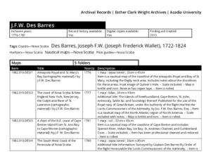
Dates: 1776 to 1781
Collection: J.F.W. Des Barres, Archival Catalogue
Description: Finding aid for the J.F.W. Des Barres fonds.
Type: finding aid
Dates: 1781
Collection: J.F.W. Des Barres
Description: 1 map : col. ; 32cm x 63cm. Item is a nautical map of the coastline of Cape Breton and includes Spanish River, Indian Bay, Ice Bay, St. Andrews Channel, and Cumberland Cove.
Accession Number: 1982.010-DES/003
Dates: 1776
Collection: J.F.W. Des Barres
Description: 1 map : sepia toned ; 33cm x 45cm. Item is a nautical map of the coastline of the Annapolis Royal and Bay of St. Mary, including the Digby neck area, by J.F.W. Des Barres. Includes notes about the shorelines for these areas. Inset image of Guliver's Hole.
Accession Number: 1982.010-DES/001
Dates: 1777
Collection: J.F.W. Des Barres
Description: 1 map : b&w ; 32cm x 61cm. Item is a nautical map of the coastline of northern Nova Scotia and includes the coasts of the Island of St. John and Cape Breton as well as Northumberland Straight and the Gulf of St. Lawrence, by J.F.W. Des Barres.
Accession Number: 1982.010-DES/005
Dates: 1777
Collection: J.F.W. Des Barres
Description: 1 map : b&w ; 34cm x 49cm by J.F.W. Des Barres. Item is a nautical map of the North Atlantic region of North America.
Additional title: The Islands of Newfoundland, Cape Breton, St. John, Antecosty, Sable &c. and Soundings thereof; Published for the use of the Royal navy of Great Britain, under the Authority ofthe Right Hon'blethe Lords Commissioners of the Admiralty, by Jos… more Accession Number: 1982.010-DES/002
Dates: 1780
Collection: J.F.W. Des Barres
Description: 1 map : sepia toned ; 30cm x 85cm. Item is a nautical map of the coastline along the southern shore of Nova Scotia from Yarmouth to Sambro and includes Barrington Bay, Port Haldimand, Port Buller, Stormont River, Gambier Harbour, and Mecklenburg Bay, by J.F. W. Des Barres. Additional title information: Surveyed by Captain Des Barres By Order of the Right Honourable the Lords Commissioners of the… more Accession Number: 1982.010-DES/004


